
Buzzards Bay and New Bedford Marine Weather
Marine Forecast
View all
OVERNIGHT NW winds 10 to 15 kt. Gusts up to 20 kt. Seas around 2 ft. Wave Detail: W 2 ft at 5 seconds and E 1 foot at 6 seconds.
SUN NW winds 10 to 15 kt with gusts up to 20 kt. Seas 2 to 3 ft. Wave Detail: SW 2 ft at 6 seconds and NW 1 foot at 3 seconds.
SUN NIGHT NW winds 10 to 15 kt. Gusts up to 20 kt in the evening. Seas around 2 ft. Wave Detail: NW 1 foot at 2 seconds and SW 1 foot at 6 seconds.
MON NW winds 10 to 15 kt, diminishing to 5 to 10 kt in the afternoon. Seas around 2 ft in the morning, then 1 foot or less. Wave Detail: NE 2 ft at 5 seconds and W 1 foot at 3 seconds, becoming W 1 foot at 3 seconds and NE 1 foot at 5 seconds.
MON NIGHT NW winds 5 to 10 kt. Seas 1 foot or less. Wave Detail: W 1 foot at 3 seconds and N 1 foot at 4 seconds.
TUE AND TUE NIGHT W winds 5 to 10 kt. Seas 1 foot or less. Wave Detail: W 1 foot at 3 seconds and NE 1 foot at 4 seconds.
WED THROUGH THU NIGHT W winds 5 to 10 kt. Seas around 2 ft. Seas are reported as significant wave height, which is the average of the highest third of the waves. Individual wave heights may be more than twice the significant wave height.
SUN NW winds 10 to 15 kt with gusts up to 20 kt. Seas 2 to 3 ft. Wave Detail: SW 2 ft at 6 seconds and NW 1 foot at 3 seconds.
SUN NIGHT NW winds 10 to 15 kt. Gusts up to 20 kt in the evening. Seas around 2 ft. Wave Detail: NW 1 foot at 2 seconds and SW 1 foot at 6 seconds.
MON NW winds 10 to 15 kt, diminishing to 5 to 10 kt in the afternoon. Seas around 2 ft in the morning, then 1 foot or less. Wave Detail: NE 2 ft at 5 seconds and W 1 foot at 3 seconds, becoming W 1 foot at 3 seconds and NE 1 foot at 5 seconds.
MON NIGHT NW winds 5 to 10 kt. Seas 1 foot or less. Wave Detail: W 1 foot at 3 seconds and N 1 foot at 4 seconds.
TUE AND TUE NIGHT W winds 5 to 10 kt. Seas 1 foot or less. Wave Detail: W 1 foot at 3 seconds and NE 1 foot at 4 seconds.
WED THROUGH THU NIGHT W winds 5 to 10 kt. Seas around 2 ft. Seas are reported as significant wave height, which is the average of the highest third of the waves. Individual wave heights may be more than twice the significant wave height.
Buzzards Bay and New Bedford Nautical Charts
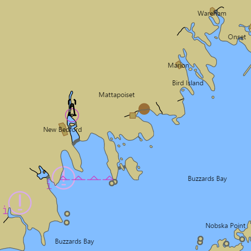
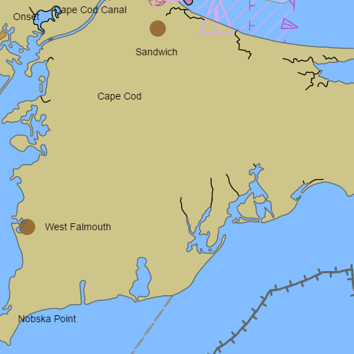
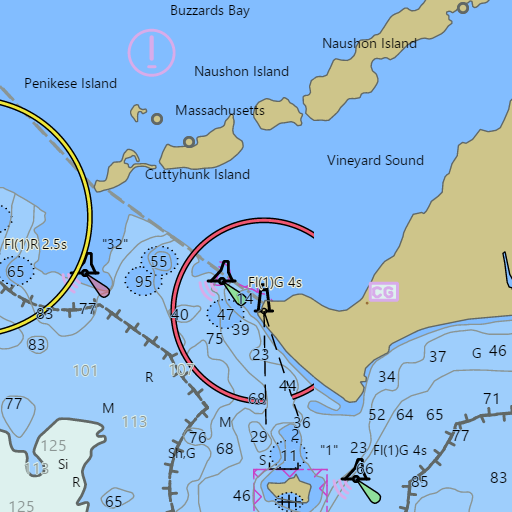
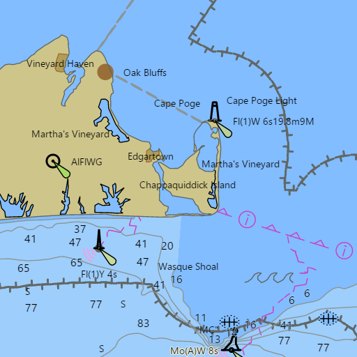
NOAA nautical charts with your GPS position and a wind map for Buzzards Bay and New Bedford in the Wind and Tides app


Weather
View allTonight
39°F
Partly Cloudy
14 mph NW
Sunday
50°F
Sunny
16 mph NW
Sunday Night
39°F
Mostly Clear
14 mph NW
Monday
50°F
Sunny
6 to 14 mph NW
Tides and Currents
View all| Time (EST) | Event | Height/Speed |
|---|---|---|
| Sat, Nov 14 9:46 PM | flood | 0.3 kts |
| Sat, Nov 14 11:21 PM | high | 2.9 ft |
| Sun, Nov 15 12:11 AM | slack | slack |
| Sun, Nov 15 2:18 AM | ebb | 0.4 kts |
| Sun, Nov 15 4:12 AM | low | 0.7 ft |
| Sun, Nov 15 6:14 AM | slack | slack |
| Sun, Nov 15 9:47 AM | flood | 0.2 kts |
| Sun, Nov 15 11:44 AM | high | 3.2 ft |
| Sun, Nov 15 11:51 AM | slack | slack |
| Sun, Nov 15 2:57 PM | ebb | 0.6 kts |
| Sun, Nov 15 5:22 PM | low | 0.9 ft |
| Sun, Nov 15 8:17 PM | slack | slack |
Marine weather for Buzzards Bay, the Elizabeth Islands, and the west end of the Cape Cod Canal — Westport, the Westport River, Horseneck Beach, South Dartmouth, Padanaram, New Bedford, New Bedford Harbor, the Hurricane Barrier, Fairhaven, Mattapoisett, Marion, Sippican Harbor, Wareham, Onset, Pocasset, Red Brook Harbor, Cataumet, Megansett, West Falmouth, Quissett Harbor, Woods Hole, Hadley Harbor, and Cuttyhunk, Massachusetts. Wind, tides, and conditions for sailing, boating, cruising, fishing, kayaking, paddleboarding, windsurfing, kiteboarding, and wing foiling.