
Key Largo and Islamorada Marine Weather
Marine Forecast
View all
TONIGHT East to southeast winds 5 to 10 knots, increasing to near 10 knots. Seas 1 to 2 feet. Nearshore waters smooth to a light chop, becoming a light chop. A slight chance of showers.
TUESDAY AND TUESDAY NIGHT East to southeast winds near 10 knots. Seas around 2 feet. Nearshore waters a light chop. A slight chance of showers.
WEDNESDAY East to southeast winds near 10 knots, decreasing to near 5 knots. Seas 1 to 2 feet, subsiding to around 1 foot. Nearshore waters a light chop, becoming smooth to a light chop. A slight chance of showers.
WEDNESDAY NIGHT Southeast winds near 5 knots, becoming south to southwest. Seas around 1 foot. Nearshore waters smooth. A slight chance of showers.
THURSDAY Southwest winds 5 to 10 knots, becoming southwest to west and increasing to near 10 knots. Seas around 1 foot, building to 1 to 2 feet. Nearshore waters smooth to a light chop, becoming a light chop. A slight chance of showers and thunderstorms.
THURSDAY NIGHT West to northwest winds 10 to 15 knots. Seas around 2 feet. Nearshore waters smooth to a light chop. A chance of showers.
FRIDAY Northwest winds 10 to 15 knots, increasing to near 15 knots. Seas building to 2 to 3 feet, except building to 3 to 4 feet, occasionally to 5 feet west of Cosgrove Shoal Light. Nearshore waters a light to moderate chop, becoming a moderate chop. A slight chance of showers and thunderstorms.
FRIDAY NIGHT Northwest to north winds 15 to 20 knots, increasing to near 20 knots. Seas 3 to 4 feet, occasionally to 5 feet, except 4 to 5 feet, occasionally to 6 feet west of Cosgrove Shoal Light. Nearshore waters choppy, becoming rough.
SATURDAY North winds near 20 knots, decreasing to near 15 knots. Seas subsiding to 2 to 3 feet, except subsiding to 3 to 4 feet, occasionally to 5 feet west of Cosgrove Shoal Light. Nearshore waters choppy, becoming a light to moderate chop.
SATURDAY NIGHT North to northeast winds near 15 knots. Seas 2 to 3 feet, except 3 to 4 feet, occasionally to 5 feet west of Cosgrove Shoal Light. Nearshore waters a moderate chop.
TUESDAY AND TUESDAY NIGHT East to southeast winds near 10 knots. Seas around 2 feet. Nearshore waters a light chop. A slight chance of showers.
WEDNESDAY East to southeast winds near 10 knots, decreasing to near 5 knots. Seas 1 to 2 feet, subsiding to around 1 foot. Nearshore waters a light chop, becoming smooth to a light chop. A slight chance of showers.
WEDNESDAY NIGHT Southeast winds near 5 knots, becoming south to southwest. Seas around 1 foot. Nearshore waters smooth. A slight chance of showers.
THURSDAY Southwest winds 5 to 10 knots, becoming southwest to west and increasing to near 10 knots. Seas around 1 foot, building to 1 to 2 feet. Nearshore waters smooth to a light chop, becoming a light chop. A slight chance of showers and thunderstorms.
THURSDAY NIGHT West to northwest winds 10 to 15 knots. Seas around 2 feet. Nearshore waters smooth to a light chop. A chance of showers.
FRIDAY Northwest winds 10 to 15 knots, increasing to near 15 knots. Seas building to 2 to 3 feet, except building to 3 to 4 feet, occasionally to 5 feet west of Cosgrove Shoal Light. Nearshore waters a light to moderate chop, becoming a moderate chop. A slight chance of showers and thunderstorms.
FRIDAY NIGHT Northwest to north winds 15 to 20 knots, increasing to near 20 knots. Seas 3 to 4 feet, occasionally to 5 feet, except 4 to 5 feet, occasionally to 6 feet west of Cosgrove Shoal Light. Nearshore waters choppy, becoming rough.
SATURDAY North winds near 20 knots, decreasing to near 15 knots. Seas subsiding to 2 to 3 feet, except subsiding to 3 to 4 feet, occasionally to 5 feet west of Cosgrove Shoal Light. Nearshore waters choppy, becoming a light to moderate chop.
SATURDAY NIGHT North to northeast winds near 15 knots. Seas 2 to 3 feet, except 3 to 4 feet, occasionally to 5 feet west of Cosgrove Shoal Light. Nearshore waters a moderate chop.
Key Largo and Islamorada Nautical Charts
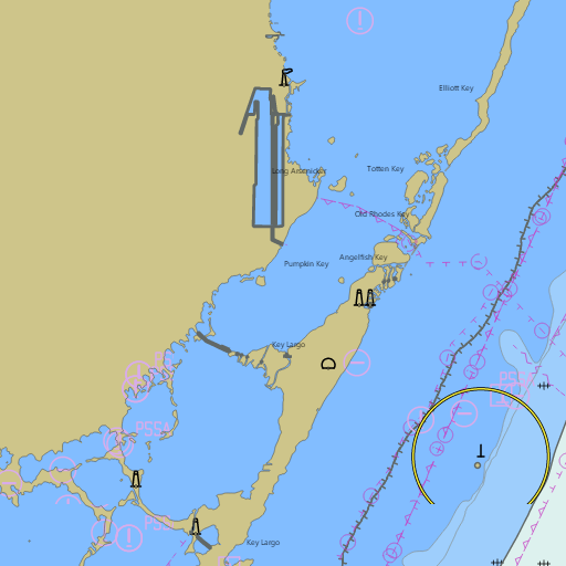
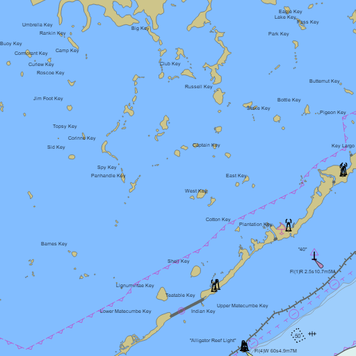
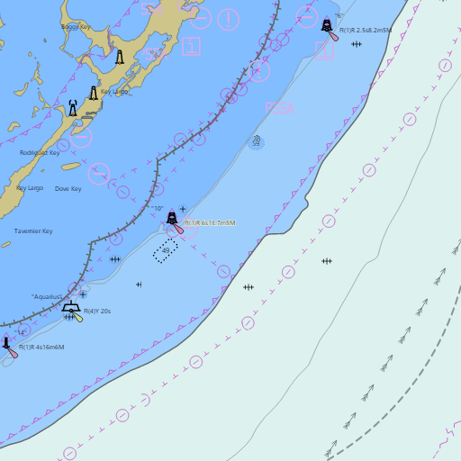
NOAA nautical charts with your GPS position and a wind map for Key Largo and Islamorada in the Wind and Tides app


Weather
View allTonight
78°F
Slight Chance Rain Showers
10 mph E
Tuesday
84°F
Slight Chance Rain Showers
10 to 15 mph E
Tuesday Night
78°F
Slight Chance Rain Showers
10 mph E
Veterans Day
84°F
Slight Chance Rain Showers
5 to 10 mph SE
Tides
View all| Time (EST) | Event | Height |
|---|---|---|
| Mon, Nov 9 8:45 PM | high | 2.6 ft |
| Tue, Nov 10 2:52 AM | low | 0.3 ft |
| Tue, Nov 10 9:21 AM | high | 2.8 ft |
| Tue, Nov 10 3:19 PM | low | 0.8 ft |
| Tue, Nov 10 9:22 PM | high | 2.5 ft |
| Wed, Nov 11 3:30 AM | low | 0.3 ft |
| Wed, Nov 11 9:59 AM | high | 2.7 ft |
| Wed, Nov 11 3:57 PM | low | 0.9 ft |
| Wed, Nov 11 9:59 PM | high | 2.5 ft |
| Thu, Nov 12 4:08 AM | low | 0.5 ft |
| Thu, Nov 12 10:38 AM | high | 2.6 ft |
| Thu, Nov 12 4:36 PM | low | 1.0 ft |
Marine weather for Hawk Channel, the reef, Blackwater Sound, Buttonwood Sound, and the Florida Bay backcountry — Ocean Reef, North Key Largo, John Pennekamp State Park, Key Largo, the Upper Keys Sailing Club, Rodriguez Key, Molasses Reef, Tavernier, Tavernier Creek, Whale Harbor, the Islamorada sandbar, Bud n' Mary's, Indian Key, Alligator Reef, Lower Matecumbe Key, and Islamorada, Florida. Wind, Key Largo tides and the Key Largo tide chart, the Islamorada tide chart, the Key Largo marine weather forecast, the Key Largo boating forecast, the Upper Florida Keys marine forecast, the Key Largo wind forecast, and conditions for sailing, the Buccaneer Blast regatta, boating, diving, snorkeling, reef and backcountry fishing, kayaking, and paddleboarding.