
Catalina and Channel Islands Marine Weather
Marine Forecast
View all
TONIGHT W wind 10 to 20 kt, becoming NW 5 to 10 kt after midnight. Seas 2 to 4 ft. Wave Detail: W 4 ft at 7 seconds and SW 2 ft at 12 seconds.
FRI Light winds, becoming W 10 to 15 kt in the afternoon. Seas 2 to 4 ft. Wave Detail: W 2 ft at 6 seconds and S 2 ft at 13 seconds. Patchy fog in the morning.
FRI NIGHT W wind 10 to 15 kt in the evening, becoming light. Seas 3 to 4 ft. Wave Detail: W 2 ft at 6 seconds and S 3 ft at 12 seconds.
SAT Light winds, becoming W 10 to 15 kt in the afternoon. Seas 3 to 4 ft. Wave Detail: NW 2 ft at 6 seconds and S 4 ft at 13 seconds.
SAT NIGHT NW wind 10 to 15 kt, becoming 5 to 10 kt after midnight. Seas 3 to 5 ft. Wave Detail: NW 3 ft at 5 seconds and S 4 ft at 13 seconds. A slight chance of showers after midnight.
SUN NW wind 5 to 10 kt, becoming W 15 to 20 kt in the afternoon. Seas 4 to 6 ft. Wave Detail: NW 3 ft at 6 seconds and S 5 ft at 14 seconds. A chance of showers. A slight chance of tstms in the afternoon.
SUN NIGHT NW wind 10 to 20 kt becoming 5 to 10 kt after midnight. Seas 4 to 6 ft. Wave Detail: W 3 ft at 6 seconds and S 4 ft at 13 seconds.
MON W wind 5 to 10 kt. Seas 4 to 5 ft. Wave Detail: NW 2 ft at 6 seconds and S 5 ft at 13 seconds.
MON NIGHT W wind 10 to 15 kt, becoming 5 to 10 kt after midnight. Seas 4 to 5 ft. Wave Detail: W 2 ft at 5 seconds and S 4 ft at 13 seconds. A slight chance of showers after midnight.
TUE NW wind 5 to 10 kt, becoming W 10 to 15 kt in the afternoon. Seas 3 to 5 ft. Wave Detail: NW 2 ft at 5 seconds and S 4 ft at 12 seconds.
TUE NIGHT W wind 10 to 20 kt. Seas 3 to 4 ft. Wave Detail: W 2 ft at 5 seconds and S 3 ft at 12 seconds. Winds and seas higher in and near tstms.
FRI Light winds, becoming W 10 to 15 kt in the afternoon. Seas 2 to 4 ft. Wave Detail: W 2 ft at 6 seconds and S 2 ft at 13 seconds. Patchy fog in the morning.
FRI NIGHT W wind 10 to 15 kt in the evening, becoming light. Seas 3 to 4 ft. Wave Detail: W 2 ft at 6 seconds and S 3 ft at 12 seconds.
SAT Light winds, becoming W 10 to 15 kt in the afternoon. Seas 3 to 4 ft. Wave Detail: NW 2 ft at 6 seconds and S 4 ft at 13 seconds.
SAT NIGHT NW wind 10 to 15 kt, becoming 5 to 10 kt after midnight. Seas 3 to 5 ft. Wave Detail: NW 3 ft at 5 seconds and S 4 ft at 13 seconds. A slight chance of showers after midnight.
SUN NW wind 5 to 10 kt, becoming W 15 to 20 kt in the afternoon. Seas 4 to 6 ft. Wave Detail: NW 3 ft at 6 seconds and S 5 ft at 14 seconds. A chance of showers. A slight chance of tstms in the afternoon.
SUN NIGHT NW wind 10 to 20 kt becoming 5 to 10 kt after midnight. Seas 4 to 6 ft. Wave Detail: W 3 ft at 6 seconds and S 4 ft at 13 seconds.
MON W wind 5 to 10 kt. Seas 4 to 5 ft. Wave Detail: NW 2 ft at 6 seconds and S 5 ft at 13 seconds.
MON NIGHT W wind 10 to 15 kt, becoming 5 to 10 kt after midnight. Seas 4 to 5 ft. Wave Detail: W 2 ft at 5 seconds and S 4 ft at 13 seconds. A slight chance of showers after midnight.
TUE NW wind 5 to 10 kt, becoming W 10 to 15 kt in the afternoon. Seas 3 to 5 ft. Wave Detail: NW 2 ft at 5 seconds and S 4 ft at 12 seconds.
TUE NIGHT W wind 10 to 20 kt. Seas 3 to 4 ft. Wave Detail: W 2 ft at 5 seconds and S 3 ft at 12 seconds. Winds and seas higher in and near tstms.
Catalina and Channel Islands Nautical Charts
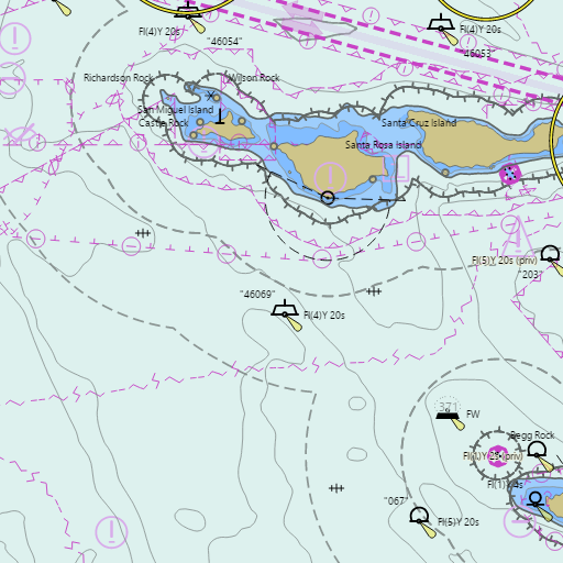
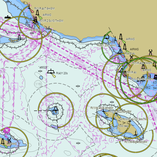
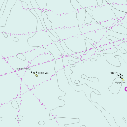
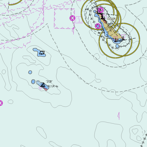
NOAA nautical charts for Catalina and Channel Islands in the Wind and Tides app


Weather
View allToday
72°F
Sunny
15 mph W
Tonight
64°F
Partly Cloudy then Patchy Fog
5 to 15 mph W
Friday
73°F
Patchy Fog then Mostly Sunny
5 to 15 mph WSW
Friday Night
65°F
Mostly Clear
5 to 15 mph WNW
Tides
View all| Time | Event | Height |
|---|---|---|
| Thu, Sep 3 1:48 PM | high | 5.4 ft |
| Thu, Sep 3 10:07 PM | low | 0.9 ft |