Catalina and Channel Islands Marine Weather
Marine Forecast
View all
TODAY Light winds, becoming W 10 to 20 kt this afternoon. Seas 3 to 4 ft. Wave Detail: W 2 ft at 6 seconds and S 2 ft at 15 seconds. Patchy fog this morning.
TONIGHT W wind 10 to 20 kt, becoming NW 5 to 10 kt after midnight. Seas 3 to 4 ft. Wave Detail: NW 3 ft at 5 seconds and S 2 ft at 15 seconds. Patchy fog.
MON W wind 5 to 10 kt, becoming 10 to 20 kt in the afternoon. Seas 2 to 3 ft. Wave Detail: W 2 ft at 6 seconds and S 2 ft at 15 seconds. Patchy fog in the morning.
MON NIGHT W wind 10 to 20 kt, becoming 5 to 10 kt after midnight. Seas 3 to 4 ft. Wave Detail: W 3 ft at 5 seconds and S 2 ft at 15 seconds. Patchy fog.
TUE W wind 5 to 10 kt, becoming 10 to 15 kt in the afternoon. Seas 3 to 4 ft. Wave Detail: W 2 ft at 6 seconds and S 2 ft at 16 seconds. Patchy fog.
TUE NIGHT W wind 10 to 20 kt, becoming 5 to 10 kt after midnight. Seas 3 to 4 ft. Wave Detail: W 3 ft at 6 seconds and S 2 ft at 16 seconds. Patchy fog.
WED W wind 5 to 10 kt, becoming 10 to 15 kt in the afternoon. Seas 3 to 4 ft. Wave Detail: W 3 ft at 6 seconds and S 3 ft at 16 seconds. Patchy fog in the morning.
WED NIGHT W wind 10 to 20 kt, becoming 5 to 10 kt after midnight. Seas 3 to 4 ft. Wave Detail: W 3 ft at 6 seconds and S 2 ft at 15 seconds.
THU Light winds, becoming W 5 to 10 kt in the afternoon. Seas 2 to 4 ft. Wave Detail: W 3 ft at 6 seconds and SW 3 ft at 15 seconds.
THU NIGHT W wind 10 to 15 kt, becoming 5 to 10 kt after midnight. Seas 3 to 5 ft. Wave Detail: NW 4 ft at 5 seconds and SW 3 ft at 14 seconds.
Catalina and Channel Islands Nautical Charts
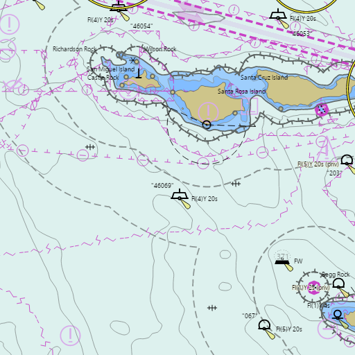
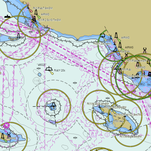
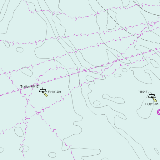
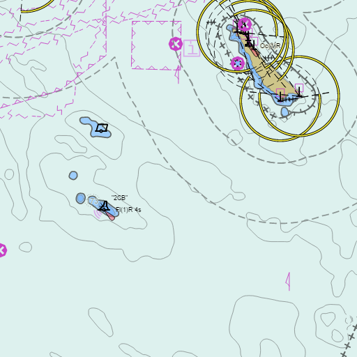
Charts for Catalina and Channel Islands in the Wind and Tides app
![]()
![]()
Weather
View allOvernight
61°F
Patchy Fog
5 mph WNW
Sunday
72°F
Patchy Fog then Partly Sunny
5 to 10 mph WNW
Sunday Night
61°F
Patchy Fog
5 to 10 mph WNW
Monday
72°F
Patchy Fog then Mostly Sunny
5 to 10 mph WNW
Tides & Currents
View all| Time | Event | Height/Speed |
|---|---|---|
| Sun, Jun 14 3:42 AM | low | -1.7 ft |
| Sun, Jun 14 10:15 AM | high | 3.6 ft |
| Sun, Jun 14 2:28 PM | low | 2.1 ft |
| Sun, Jun 14 8:59 PM | high | 7.1 ft |